Kannur District came into existence on 1st January 1957. Under the revenue system the District is divided into 3 Taluks viz. Talipparamba, Kannur and Thalassery. Out of 129 villages, 47 villages are in Talipparamba Taluk, 34 villages in Kannur Taluk and 48 villages in Thalassery Taluk.
MSMEs Started during the period 2011-16
Wayanad district –So called the “Green paradise” is also known as the “land of Spicy Hills” for its tedious treasures. It has a long history going back for many centuries. Situated (E. long 75° 47’ 23" and 76° 26’ 40" and N.Lat 11° 30’ 08" and 11° 58’ 40"; area of 2131 Km2) in Malabar is one of the border districts of Kerala, fringing the Mysore plateau to the north east and contiguous with the Nilgris of TamilNadu. It was formed on November 1, 1980 merging parts of North Wayanad taluk of Kozhikode (Calicut) and south Wayanad taluk of Kannur District.
Wayanad has a powerful history. Historians are of the view that organized human life existed in these parts, at least ten centuries before Christ. Countless evidences about New Stone Age civilization can be seen on the hills of Wayanad. The two caves of Ampukuthimala located between Sulthan Bathery and Ambalavayal, with pictures on their walls and pictorial writings, speak volumes of the bygone era and civilization. Recorded history of this district is available from the 18th century. Kerala was a major spice exporter as early as 3000 BC, according to Sumerian records. Its fame as the land of spices attracted ancient Babylonians, Assyrians and Egyptians to the Malabar Coast in the 3rd and 2nd millennia BCE. Arabs and Phoenicians were also successful in establishing their prominence in the Kerala trade during this early period. They had a great perspective view on the spice trade. So they travelled along the deep forests of Wayanad and reached the plateau of hidden secrets. The British opened the plateau of cultivation of tea & other cash crops and laid roads from Kozhikode (Calicut) and Thallassery to Ooty and Mysore through Wayanad. They lead this area to develop as major plantations like tea, coffee, rubber and various spices. This region is one of the largest producers of many spices especially cardamom from which it earns its name.
MSMEs started during 2011-16
TRANSPORT AND COMMUNICATION
1. Roads
The district has fairly extensive road network. The length of national highway, state highway and major district roads in the district are furnished below.
|
Road
|
Length (in Kms.)
|
|
National Highway
|
129.5
|
|
State Highway
|
333.548
|
|
Major District Road
|
2033.934
|
|
Total
|
2496.982
|
National Highways run almost parallel to coastal line linking to head quarters of 3 Taluks namely Kozhikode, Koilandy and Vatakara.
2. Railways
The district has 75.48 Kms. broad gauge railway lines with 18 stations in the district. Railway plays a crucial role in the passenger as well as goods traffic in the district.
3. Airport
Karipur International Airport is only 26.5 Kms away from the city. Now flights are operated from Kozhikode to Middle East countries. In the near future, Kozhikode will regain the past glory through the expansion of Calicut Airport as the doors of international trade are being opened.
4. Port
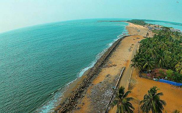
Beypore is located in Kozhikode at the mouth of the Chaliyar River. Historically, it has a special place as being one of the prominent ports and fishing harbours, and was also an important trade and maritime centre during the days of the early Arab and Chinese travellers and later the Europeans. Soon after gaining prominence as a port and trade centre, Beypore slowly began to flourish as a centre for shipbuilding, since ships were in great demand merchants from Western Asia. The shipbuilding yard at Beypore port is famous for its traditional construction of the Uru or the Arabian trading vessel. This tradition of shipbuilding is nearly 1,500 years old, and the craftsmanship of the workers here is exceptional. The average income of beypore fishing harbor during the year 2012-13 is `14.53 lakhs.
5. Postal and Telecommunication
The Kozhikode District has fairly well developed network of Post Office and Also a wide acclaimed BSNL, Reliance, DOCOMO, Airtel, Vodafone, are functioning .
ELECTRICITY
All the villages in the Kozhikode district are electrified. Almost 64.72 % of the total consumption is used for the domestic purposes. Only 11.37 % is used for the Industrial purposes. The nearest power generating station is at Kuttiady near Kozhikode. The extra high tension substation in the district is linked to the Kerala Power grid through EHT. The transmission networks consist of Three 220 KV feeders, Twelve 110 KV feeders, Seven 66 KV feeders, and Nine 33 KV feeders. Moreover in the distribution section 2264 transformers are included. The length of HT lines is 1805 Kms and the length of the LT lines is 20609.5 Kms. The total number of consumers in the district is 6751037 in numbers.
BANKING
Kozhikode district has good network of banking activities. Canara Bank is the Lead Bank of the district. There are 225 Branches of the Nationalized Banks and 88 branches of private banks spread over the district. Out of this 112 of the nationalized banks and 42 Private Banks are situated in rural areas. Also 49 branches for Kozhikode district co-operative banks and 113 service co-operative banks are also in the district.
INDUSTRIAL ESTATES
|
Industrial Estate
|
Extend of Land
(in cents)
|
Land Allotted
|
No. of Plots
|
No. of units
|
No. units Working
|
|
DP West Hill
|
1263
|
1030
|
37
|
37
|
33
|
|
Kattippara
|
2034
|
Under Development
|
|
SIDCO, West Hill
|
1244
|
1244
|
42
|
42
|
42
|
|
Nallalam DP
|
972
|
700
|
46
|
41
|
41
|
|
KSIDC, Kinaloor
|
30800
|
15000
|
60
|
19
|
19
|
|
Status of Mini Industrial Estates as 31/12/2016
|
|
MIE
|
Total Area
(in cents)
|
Total No. of Sheds
|
No. of units working
|
No. of Dormant units
|
Vacant Sheds
|
|
Under DIC
|
|
Balussery
|
100
|
10
|
4
|
6
|
0
|
|
Chathamangalam
|
100
|
15
|
13
|
2
|
0
|
|
Kunnamangalam
|
100
|
16
|
14
|
2
|
0
|
|
Kunnummal
|
100
|
10
|
8
|
2
|
0
|
|
Naduvannur
|
100
|
17
|
12
|
5
|
0
|
|
Payyoli
|
100
|
12
|
9
|
3
|
0
|
|
Peruvayal
|
100
|
10
|
9
|
1
|
0
|
|
Unnikulam
|
100
|
10
|
9
|
1
|
0
|
|
Total
|
800
|
100
|
78
|
22
|
0
|
|
Under SIDCO
|
|
Kadalundi
|
100
|
12
|
12
|
0
|
0
|
|
Perambra
|
100
|
13
|
13
|
0
|
0
|
|
Moodadi
|
377
|
29
|
12
|
0
|
0
|
|
Total
|
477
|
44
|
37
|
0
|
0
|
Kozhikode District, Once the capital of the powerful Zamorins and a prominent trade and commerce Centre, Kozhikode was the most important region of Malabar in the days gone by. Today, lush green countryside, serene beaches, historic sites, wildlife sanctuaries, rivers, hills, a unique culture and a warm, friendly ambience make Kozhikode a popular destination. Kozhikode District found a place in the World History with the discovery of Sea Route to India in 1498 by the Portuguese Navigator Vasco Da Gama. Kozhikode is a historical town with a glorious past. From time immemorial, the city attracted travelers, with its charming physical features and prosperity.
The district comprises of 4 taluks viz. Kozhikode, Vatakara, Koilandy and Thamarassery which are subdivided into 118 revenue villages. The district is also divided into 12 Blocks Panchayats, 7 municipalities and 70 Grama Panchayats. The headquarters of the district namely, Kozhikode is one among the five city corporations of the state. There are 13 assembly constituencies and 2 Parliament constituencies.
Kozhikode with all its achievements in physical quality of life of people, quality of infrastructure, availability of qualified man power, natural and agricultural resources, good climate remains in the industrial front. Even though the district is one among the leading district in Kerala, as far as industrial scenario is considered it still remains industrially back ward in spite of vast unemployed educated man power and high rates of savings of large Gulf employees.
GENERAL PARTICULARS of KOZHIKIODE DISTRICT
| Area |
2345 Sq. Km. |
| Urban Area |
2005 Sq. Km. |
| Rural Area |
340 Sq. Km. |
| No. of Taluks |
4 |
| No. of Block Panchayaths |
12 |
| No. of Municipal Corporation |
1 |
| No. of Municipalities |
7 |
| No. of Panchayaths |
70 |
| No. of Villages |
118 |
| No. of Parliament Constituencies |
2 |
| No. of Assembly Constituencies |
13 |
DEMOGRAPHY
| Total Population (Census 2011) |
3086293 |
| Male Population |
1470942 |
| Female Population |
1615351 |
| Sex Ratio (Female /1000 Male) |
1098 |
| Population Density (per Sq. Km.) |
1316 |
| Child Sex Ratio |
969 |
| Total Literacy Rate |
95.08 |
| Male Literacy Rate |
97.42 |
| Female Literacy Rate |
92.99 |
Malappuram was the military head quarters from ancient times. During the Sangam period Eranadan Malappuram was under the Chera Empire. The King of Mysore, Hydarali, conquered the places and her son, Tipu Sultan, handed over the area to the British as part of Srirangapattanam treaty. The British established the Haigh Barracks on top of the hill, at the bank of the Kadalundi river, to station their forces, where once Tipu had a fort. Main Barracks has now been turned into the seat of district administration.
Malappuram Industrial Profile
Food processing, wood and furniture, textiles and garmets, general engineering are the major sectors of industries in Malappuram district.